
Bridgeport ZIP Coverage at a Glance
Official research identifies 26330 as the primary ZIP for Bridgeport. The adjacent Clarksburg codes explain why county offices and nearby Harrison County parcels carry a different postal city. They are not additional ZIP codes for the incorporated city. Verify any single address through USPS rather than extending a city label from a county map.
| ZIP | Area represented | Post office name | Research note |
|---|---|---|---|
| 26330 | Bridgeport city and the Bridgeport postal delivery area; some nearby delivery addresses may use Bridgeport | Bridgeport, WV | Primary city ZIP; postal and municipal edges are not assumed identical |
| 26301 | Nearby Clarksburg postal area in Harrison County | Clarksburg, WV | Not identified as a Bridgeport-city ZIP |
| 26302 | Nearby Clarksburg postal area in Harrison County | Clarksburg, WV | Do not substitute it for a Bridgeport address without USPS verification |
No official Bridgeport ZIP split year, unique institutional code, or PO-box-only ZIP was found. That absence matters. The Bridgeport ZIP code directory should not turn nearby county codes into city coverage or invent a special postal category that the source record does not support.
Why Bridgeport Centers on 26330
Bridgeport sits in Harrison County, while Clarksburg is the county seat. A resident may use Bridgeport for postal delivery yet visit Clarksburg for deeds, assessments, or court files. That city-county split is why a records search can display Clarksburg office addresses without changing the ZIP for the Bridgeport property being researched.
The city grew around US Route 50, Interstate 79, and the North Central West Virginia Airport. Current planning also addresses Charles Pointe, White Oaks, annexation priorities, and Main Street redevelopment. Growth can shift municipal service lines even when a familiar postal label remains. Date each map result and save the municipality or county field shown by the source.
Search Bridgeport Through USPS Modes
The USPS ZIP Code Lookup offers three distinct paths. Choose the one that matches the fact in hand. USPS recommends its standardized city name for delivery and warns that the result does not confirm that a person or company occupies the address. Corrections may take 30 to 60 days to appear in the lookup database.
| USPS mode | Required input | Optional input | Useful result |
|---|---|---|---|
| ZIP by address | Street address, city, state | Company, unit, ZIP | Standardized delivery city and ZIP |
| ZIP by city and state | City and state | None documented | ZIP relationship for that postal city |
| Cities by ZIP | ZIP | None documented | Recognized city name or names |
A historical post-office tool can show a post office's establishment and discontinuance dates by the first three ZIP digits, but USPS warns that those records may not be current. Use it only for postal history. Use the current lookup for today's address.
Narrow Bridgeport Residents by ZIP
No official portal inspected for Bridgeport offers a public ZIP-wide resident list. USPS verifies delivery, the GIS identifies parcels, and the assessor searches owners or parcel keys. The voter status form searches one named person with a birth date. A safe workflow keeps those purposes separate.
- Enter the full street address in USPS ZIP Lookup and save the standardized city, state, and ZIP.
- Open Harrison County GIS. Use the 911 Addressing Locator or map view to find the address and parcel geometry.
- Copy the parcel district, map, parcel, and suffix. Use that key or an owner name in the county assessor form.
- Confirm a named person only in a record that supports a person search. Do not infer every occupant from an owner or postal result.
- Once the area is down to a named road, use the Bridgeport street directory for the address-level record chain.
The order matters. A postal match proves how an address should be written for delivery. GIS connects a place to map geometry. An assessor result names the tax-roll owner, who may not live there. Each source answers a smaller question than “who lives here.”
Bridgeport ZIP Search Limits
The ZIP-capable tools do not all search residents. The state business-list service accepts a Specific ZIP Codes field and other filters, but it returns business entities. The assessor's public ownership page shows owner-name, parcel, and mineral-account modes with no visible ZIP field. GIS works by map area, and the public voter form has no ZIP field.
| Portal | ZIP function | What comes back | Limit |
|---|---|---|---|
| USPS ZIP Lookup | Address, city/state, or ZIP-to-cities | Standardized postal relationship | No person confirmation |
| WV business list | Specific ZIP Codes text field | Entity list filtered with other choices | Business filings only |
| Harrison Assessor | No visible ZIP field | Owner, parcel, or mineral search | Use parcel or GIS |
| Harrison GIS | Map extent and layers | Parcels and address points | No public ZIP-wide export found |
| WV voter lookup | No ZIP field | One person's status and districts | Name and birth date required |
| Historic directories | Street or address section | Listed occupant for one year | Publisher, year, and boundary gaps |
Inspect the state business-list search before treating its ZIP option as a resident tool.
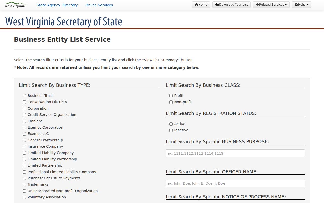
The captured page supports ZIP filtering for entity records, not a list of people who live in Bridgeport.
Bridgeport ZIP Versus City Limits
ZIP codes route mail. They are not municipal borders. A Bridgeport postal address can lie in a county pocket outside city limits, while a parcel near Bridgeport can carry Clarksburg and 26301 or 26302. County GIS, E911 address points, and city-limit layers decide jurisdiction more reliably than the postal code alone.
Harrison County's 9-1-1 addressing ordinance directs its Addressing Coordinator to work with the statewide mapping board, the Assessor, municipal corporations, USPS, and emergency agencies. That shared system explains why one location can have several valid keys. Keep each one rather than forcing them into a single label.
- ZIP Code
- A five-digit postal delivery area, not a city boundary.
- ZIP+4
- The base ZIP plus four digits that narrow delivery to a smaller segment.
- PO-box ZIP
- A code used for post-office-box delivery; none was verified as a separate Bridgeport code.
- Unique ZIP
- A code assigned to one high-volume organization; none was verified for Bridgeport.
- Carrier route
- A postal delivery path that can cross lines used by local government.
Note: Store the raw entry, postal result, parcel ID, and city-limit finding so another person can repeat the check.
Bridgeport Addresses Use Four Keys
The assessor parcel key breaks into district, map, parcel, and suffix. A deed may use lot, block, subdivision, survey, acreage, adjoining owners, or metes-and-bounds. “Situs” means the physical parcel location, while a mailing address is where the owner receives tax correspondence. Neither field is the same as a USPS delivery standard.
The Bridgeport occupancy form shows the distinction in practice. It separates the property address, the owner's mailing address, another occupant's mailing address, and business use. Older land books may identify Simpson district or land-book numbers instead of a modern road number. The Harrison IDX even includes a named 1996 Simpson District Bridgeport land-book entry.
When an old address fails, search current and former road names in Clerk road, right-of-way, and plat records. Compare the GIS Old Boundary Line and Right Of Ways layers, then check the street sections of Clarksburg-area city directories. No official Bridgeport street-renumbering schedule was found.
Map Bridgeport ZIP Areas to Parcels
The county GIS landing page provides a Tax Parcel Viewer, 911 Addressing Locator, and Voter Registration map. The underlying assessor service includes Parcels, LandHooks, Right Of Ways, Old Boundary Line, Districts, DistMap, TIF Districts, and IASData. Those layers can show why the postal city and local jurisdiction differ.
Open Harrison County GIS to compare a Bridgeport address with parcel and boundary layers.
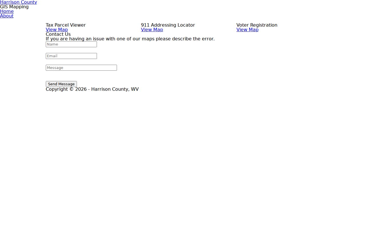
The captured landing screen gives the separate map routes needed for parcel geometry and emergency-style address points.
Start at one verified address, identify its parcel, and record the current map date. Do not claim the GIS exports everyone in 26330 because no public ZIP-wide list was found. The map narrows geography, not people.
Historic Bridgeport Searches Outgrow ZIP
ZIP codes began long after Bridgeport's early directory and land records. A household in a 1905 directory or an 1850s county book cannot be found by adding a modern code. Search the period street spelling, Bridgeport and “Bport,” Simpson district, Clarksburg-area volumes, plats, and old county boundaries.
Bridgeport's transport history adds more context. Older addresses may follow Simpson Creek, turnpike routes, rail lines, or roads that predate current subdivisions. The city's 2026 Comprehensive Plan anticipates further growth and annexation work around Charles Pointe, White Oaks, and Main Street. Future searches should date every parcel and map result.
The Bridgeport ZIP code directory is strongest as a current postal filter. Historical identity comes from the record system in use at the time, not from applying 26330 backward.