
Bridgeport Neighbor Sources by Block
The public record describes parcels, filings, and civic roles more reliably than households. For a Bridgeport block, start with the Harrison County parcel layer because it fixes the immediate geographic scope. Move one lot at a time into the assessor, deed, plat, and permit records. Voter information follows different rules and does not list all residents at an address. City boards and community resources name public contacts, not everyone who lives nearby.
| Source | What It Shows About a Block | Access |
|---|---|---|
| Harrison GIS parcel layer | Parcel polygons, adjoining geometry, roads, districts, right-of-way, and old boundary | Public map and ArcGIS identify or query |
| Assessor ownership search | Recorded owner and parcel tax key, checked one parcel at a time | Online owner form, phone, or counter |
| Deed and plat index | Lot, block, subdivision, owner, and transfer trail | County Clerk IDX, courthouse, books, and microfilm |
| Voter data | Registration address, status, party, and district fields | Person lookup or controlled data request |
| Building permits | Project address, owner, contractor, work type, and dates | City request; no online index located |
| Public civic rosters | Appointed names, roles, and terms | City pages, agendas, minutes, or records request |
| History and cemetery files | Past family, church, burial, and community connections | Library, archive, or cemetery request |
An owner may live elsewhere, and one person may own several nearby lots. A mailing address can differ from a property's situs, or physical, address. Voter registration supports residence on its record date but omits people who are not registered and may lag after a move. Permits describe work at a place. None of these sources should be converted into a private household roster.
Bridgeport Parcels Reveal Block Shape
The Harrison County GIS landing page links a Tax Parcel Viewer, 911 Addressing Locator, and Voter Registration map. The assessor map service includes Parcels, LandHooks, Right Of Ways, Old Boundary Line, Districts, DistMap, TIF Districts, and IASData. Its official service supports Identify, Find, and Query. Exact buffer or radius controls were not confirmed, so the reliable method is simple: identify the subject parcel, pan across touching polygons, and click each one.
Old Boundary Line and district layers matter near Bridgeport's edge. A nearby lot may use a Bridgeport postal address without lying inside city limits, while another may use a Clarksburg mailing city despite being close to Bridgeport. Right-of-way layers can explain why two homes that look close on an aerial image do not share direct access. Save the parcel ID and legal description before leaving the map.
Open the official Harrison GIS viewer menu to choose the parcel or addressing map.
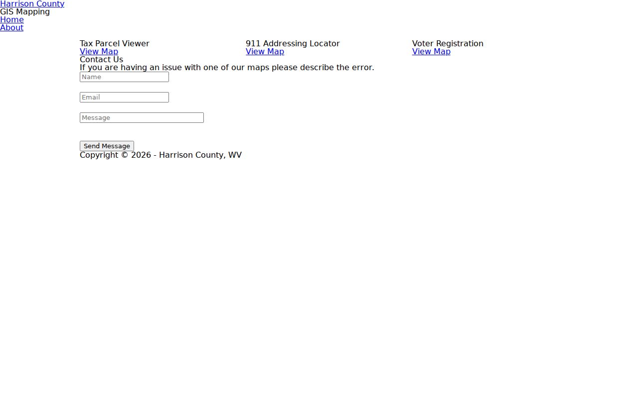
The captured landing page shows the county's separate map routes, which helps keep parcel geometry, emergency addressing, and voting geography distinct.
Map Bridgeport Neighbors Parcel by Parcel
Use a repeatable flow: address to map, map to parcel key, parcel key to owner roll, and owner name to deed or plat. This keeps the search tied to the immediate Bridgeport block instead of spreading across everyone who shares a street name.
- Locate the subject street in Harrison County's Tax Parcel Viewer or use the 911 locator to confirm the address point.
- Select the subject polygon. Copy its district, map, parcel, suffix, and legal description.
- Pan outward and select each touching parcel. Keep separate notes for situs and owner mailing addresses.
- Run the owner name through the assessor form, using last-name-first order and a percent wildcard when spelling is uncertain.
- Check deed and plat entries by legal description. Ownership is not the same as occupancy.
The assessor form does not expose a confirmed address-search field. GIS supplies the parcel key that closes that gap. A homestead flag can support an owner-occupancy theory, but it is not proof of who is present today. For a full road rather than the immediate block, use the Bridgeport street directory method.
Bridgeport Lots Share Legal Clues
Recorded plats group neighboring parcels by subdivision, lot, and block. Harrison County Clerk IDX includes large and small plats, deeds, road records, rights of way, restrictive covenants, and other land categories. A deed's legal description can tie a current parcel to a lot even when a modern street address is absent from an older filing. Compare the same subdivision and block across adjacent lots, then confirm each owner separately.
The planned areas of Charles Pointe and White Oaks appear in Bridgeport's Comprehensive Plan as development and build-out areas. That is useful planning evidence, not an HOA membership list. No official citywide neighborhood-association or HOA directory was found. Ask city planning or the developer or association for public contact and meeting information, and never infer private membership from a parcel.
Visit Harrison County IDX to search recorded plat and deed categories. The index links legal land records to the block, while its publicly visible interface does not state one clean historical cutoff.
Bridgeport Blocks Are Not Voter Lists
West Virginia's public voter tool is person keyed. It requires first name, last name, and date of birth. It returns status, party, districts, and polling place and updates nightly. It offers no public command to display all voters on a Bridgeport block. A hit confirms one registration entry, not everyone at the home, actual current presence, ownership, or any ballot choice.
The Secretary of State's voter-data request form has a broader but controlled route. Automatic fields include name, residence address and county, party, active or inactive status, and registration date. Optional fields can include birth date, mailing address, precinct, and legislative or congressional districts. Prices and terms depend on the requested product, and county-only pricing was not confirmed. A 2026 Secretary of State statement says redacted lists remain available while protected identifiers are withheld.
See the official voter status lookup and its required identity fields. The individual form shows why voter registration cannot serve as a complete block directory.
Note: Nightly updates and protected records make a voter non-match weak evidence about who is present on a Bridgeport block.
Bridgeport Civic Rosters Need Context
Bridgeport publishes public boards and committees such as the Utility Board, Planning Commission, Development Authority, Board of Zoning Appeals, Library Board, and several civil-service or public-safety bodies. Their pages, agendas, and minutes can identify appointed members, roles, and terms. The Board of Zoning Appeals has published member street addresses as civic-contact data. Treat each entry as a dated public role, not a general neighbor list.
| Name or area | Verified public evidence | Directory limit |
|---|---|---|
| Charles Pointe | Named development area in the Comprehensive Plan | No public member directory located |
| White Oaks | Named development area in the Comprehensive Plan | No public member directory located |
| City boards | Public appointees, roles, terms, meetings | Not neighborhood membership |
| Area service groups | City About page offers a community-resource lead | No member roster exposed |
| Harrison County Genealogical Society | Supports Waldomore genealogy holdings | No stable public member list located |
The safest contact path is the City of Bridgeport community overview, planning staff, public minutes, or a known association's own public contact. Private club, congregation, watch-group, and HOA member lists do not become public records merely because the group meets in Bridgeport.
Bridgeport Neighbors in Local Memory
Historical connections often outlast a current owner roll. Waldomore's Local History and Genealogy Collection holds Harrison County yearbooks, cemetery lists, obituaries, church histories, maps, family genealogies, and archives gathered since 1931. Fragile materials are appointment-only. Bridgeport Public Library offers local news and genealogy access, while the Harrison County Genealogical Society has supported Waldomore's materials.
Bridgeport Cemetery provides a rare community layer. The city describes a 1939 consolidation of three older burial grounds and a 1961 Jewish Memorial Cemetery section. Lot-owner and burial records can connect families, pioneers, veterans, former mayors, and congregations. They do not show present residence, but they can explain why names recur near an old church, road, or family tract.
Review Waldomore's research-room description before asking staff about a surname, church, block, or neighborhood. The collection expands a parcel search into dated community history without treating archival ties as proof of current occupancy.
Official Bridgeport Neighbor Records Win
Commercial neighbor tools assemble fragments from public records, marketing files, address histories, and user-contributed data. They can merge people who share a name, keep stale addresses, and attach unrelated people to one home. Official sources are narrower, but each identifies its keeper and purpose. That makes errors easier to trace and correct.
| Source type | Useful for | Main limit |
|---|---|---|
| County GIS and assessor | Parcel shape, tax key, and recorded owner | Does not list the household |
| Clerk deed and plat records | Legal land evidence and transfer history | Older entries may not use street addresses |
| Official voter channels | A dated registration entry or controlled data product | Not all residents; protected data withheld |
| Commercial category | Unverified leads | Stale, mixed, or unsupported associations |
Use a commercial result only as a lead. Return to Harrison GIS, the Assessor, the County Clerk, the City Clerk, or the Secretary of State before drawing a conclusion about people near the parcel.
Protect Privacy of Bridgeport Neighbors
Non-owner occupants, guests, children, other household members, and unregistered voters are not listed by the assessor or deed index. Utility customers, delivery records, and motor-vehicle addresses are not public neighbor-search channels. A USPS ZIP result confirms postal routing, not a person at an address. Sealed court files and restricted vital records create other deliberate gaps.
West Virginia's Address Confidentiality Program provides eligible survivors of domestic violence, sexual assault, stalking, and human trafficking with a substitute address and mail forwarding. State and local agencies and courts generally accept that address. A blank search can reflect a legal protection. Do not seek or republish the underlying residential address.
Lawful use. Research the Bridgeport block for civic curiosity, family history, reconnection, or personal safety. Never use public records to watch, stalk, harass, threaten, or intimidate a person.